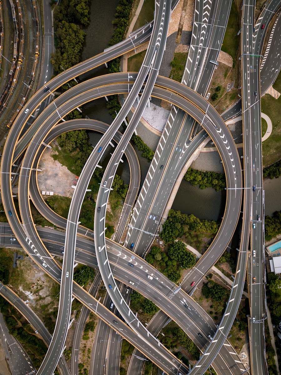
Aerial View of Road Interchange and Highway Intersection
High Resolution JPEG Picture of Aerial view of road interchange or highway intersection with busy urban traffic speeding on the road. Junction network of transportation taken by drone.
This image captures a detailed aerial view of a bustling road interchange, illustrating the intricate layout of highways and connecting roads. The image emphasizes the flow of traffic and the structural design of the interchange, making it an essential visual for transportation and urban development projects. The clear depiction of lanes and junctions provides valuable insights into traffic patterns and infrastructure planning.
This photograph can be utilized in various professional contexts, including urban planning presentations, transportation studies, and educational materials related to civil engineering. It can enhance reports, infographics, and articles on infrastructure. Additionally, it's suitable for websites focused on traffic management, city planning, or logistics. Social media posts related to urban development or transport policies can benefit from this visual aid, making it versatile for a range of applications.